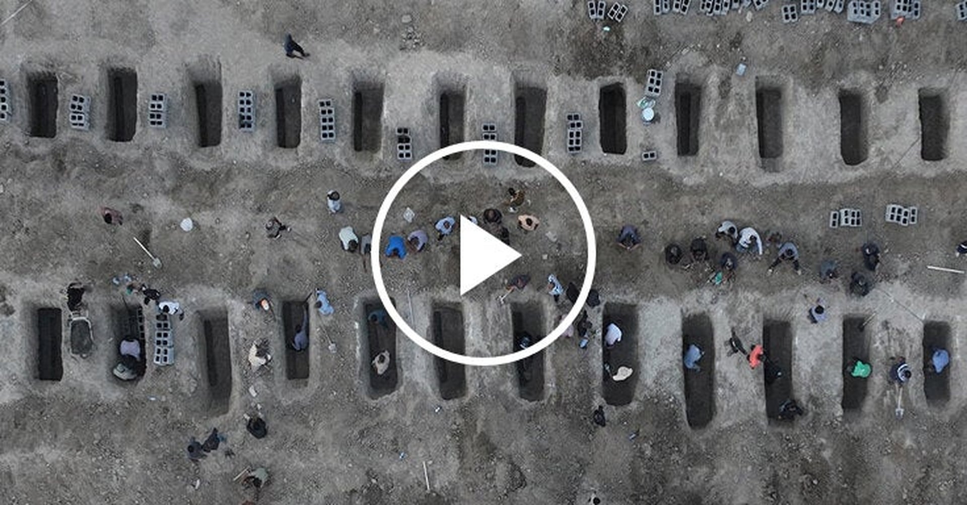
The global community was recently gripped by news of a devastating airstrike on an elementary school in southern Iran, an incident that tragically claimed the lives of at least 175 individuals, including many children, according to health officials and Iranian state media. This horrific event underscores the profound vulnerability of educational institutions and civilian populations caught in the crosscurrents of geopolitical conflict. Such attacks not only inflict immediate, irreparable loss of life but also leave deep, enduring scars on communities, disrupting the fundamental right to education and shattering the fabric of society.
In the wake of such a catastrophic event, the imperative to understand precisely what occurred, and who bears responsibility, becomes paramount. This is where the meticulous work of visual investigations teams, like the one led by Malachy Browne, plays a crucial role. These teams leverage cutting-edge analytical techniques and a diverse array of open-source intelligence to piece together the narrative of complex incidents, offering vital insights into events often shrouded in misinformation or conflicting accounts. Their methodology transforms disparate pieces of data into a coherent, evidence-based understanding, crucial for accountability and informed global discourse.
The analytical process typically commences with the acquisition and comparative analysis of high-resolution satellite imagery. By examining images captured before and after the strike, investigators can identify precise impact locations, assess the extent and nature of structural damage, and even infer the type of ordnance used based on crater characteristics and debris patterns. For instance, the presence of a large, deep crater might suggest an air-dropped bomb, while smaller, shallower impacts could point to different munitions. The precise geolocation of these impact sites, cross-referenced with known infrastructure, confirms the target's identity – in this case, an elementary school. This objective, verifiable data forms the bedrock of any credible investigation, providing an unfiltered visual record of the event.
Beyond satellite data, visual investigations integrate a wealth of open-source information. This includes publicly available photographs and videos shared on social media platforms by eyewitnesses, local journalists, or emergency responders. These digital fragments, when meticulously authenticated and geolocated, can offer ground-level perspectives that complement overhead satellite views. Analysts employ sophisticated digital forensics techniques to verify the authenticity of such content, checking metadata, analyzing shadows for time and date consistency, and cross-referencing landmarks visible in the footage with known geographical features. This painstaking process helps to filter out fabricated content and establish a reliable visual timeline of events, capturing the immediate aftermath and the human toll.
Further layers of analysis involve geospatial mapping and trajectory modeling. By mapping the damage patterns and the distribution of debris, investigators can reconstruct the likely trajectory of the incoming munition. This can sometimes provide clues about the direction of attack and, by extension, the potential origin point. Acoustic analysis, if any audio recordings of the strike are available and verifiable, can also contribute to understanding the type of weapon and its approximate speed. The convergence of these diverse data streams – satellite imagery, ground-level visuals, and technical analysis – allows for a robust reconstruction of the incident, moving beyond mere conjecture to evidence-backed conclusions.
The strike on the Iranian elementary school serves as a stark reminder of the devastating consequences when educational facilities become targets in armed conflicts. Schools, by their very nature, are intended to be sanctuaries for learning and growth, places where children can develop free from fear and violence. When these sanctuaries are violated, the impact reverberates far beyond the immediate casualties. Children who survive such attacks often endure profound psychological trauma, manifesting as anxiety, depression, and post-traumatic stress disorder, which can hinder their development and learning for years to come. The destruction of school infrastructure also means a loss of educational opportunities for an entire generation, perpetuating cycles of poverty and instability.
The reported death toll of 175 individuals highlights the indiscriminate nature of such attacks and the tragic reality that civilians, particularly the most vulnerable, bear the brunt of hostilities. Health officials face immense pressure to cope with mass casualties, often with limited resources, exacerbating an already dire humanitarian situation. The long-term health implications extend beyond physical injuries, encompassing the mental health crisis that grips affected communities. Families are torn apart, livelihoods are destroyed, and the collective sense of security is irrevocably shattered.
This incident is not isolated but reflects a disturbing global trend where schools, hospitals, and other civilian infrastructure are increasingly targeted or caught in the crossfire of conflicts. International humanitarian law explicitly prohibits attacks on civilian objects and mandates the protection of civilians, including children, in armed conflict. The targeting of an elementary school constitutes a grave breach of these principles, calling for immediate condemnation and a thorough, impartial investigation to hold perpetrators accountable. The global community has a collective responsibility to uphold these protections and ensure that education remains a beacon of hope, even in the darkest times.
While the visual evidence can meticulously detail the how and what of an attack, definitively attributing responsibility for such strikes in complex geopolitical landscapes remains a formidable challenge. The Middle East, in particular, is a region characterized by multiple state and non-state actors, proxy conflicts, and rapidly shifting alliances, making clear attribution difficult without direct admission or irrefutable intelligence. Various regional powers and their proxies operate with varying degrees of overtness, and the fog of war often obscures the true origins of military actions. However, the rigorous analysis undertaken by visual investigation teams provides critical data points that can inform intelligence assessments and diplomatic efforts. By narrowing down potential weapon types, trajectories, and operational capabilities, these investigations contribute significantly to the intelligence picture, helping policymakers and international bodies make more informed judgments. The very act of conducting such an open-source investigation, making its findings transparent, also serves as a crucial mechanism for demanding accountability. It puts pressure on all parties to a conflict to adhere to international humanitarian law and to be transparent about their military operations.
For organizations like the Nivaran Foundation, the implications of such attacks are profound. Our mission is intrinsically linked to safeguarding health and education globally, and incidents like the Iranian school strike represent a direct assault on these foundational pillars of human development. We advocate for the robust protection of educational facilities and personnel, recognizing that an attack on a school is an attack on the future of a community and, indeed, the world. Our work involves not only reporting on these tragedies but also supporting initiatives that rebuild educational infrastructure, provide psychosocial support to affected children, and champion the principles of international law that protect these vital spaces. The international community's response to such atrocities is critical. It must extend beyond condemnation to concrete actions that reinforce the sanctity of civilian life and infrastructure. This includes diplomatic pressure, support for independent investigations, and humanitarian aid to help communities recover and rebuild. The long-term stability and prosperity of any region are inextricably linked to its ability to educate its youth and provide adequate healthcare, both of which are severely undermined by acts of violence against civilian targets.
The tragic strike on the elementary school in southern Iran stands as a stark testament to the ongoing human cost of conflict. While the visual investigations team meticulously pieces together the physical evidence, the true measure of this tragedy lies in the lives lost, the futures shattered, and the profound disruption to education and well-being. Nivaran Foundation remains committed to highlighting these critical global issues, advocating for the protection of children and educational environments, and supporting efforts to ensure that such devastating events are thoroughly investigated and perpetrators held to account. It is only through a collective global commitment to peace, protection, and accountability that we can hope to prevent similar tragedies from unfolding in the future and safeguard the fundamental rights of all individuals, especially the most vulnerable, to health and education.
Support Nivaran Foundation's efforts to protect education and health in conflict zones worldwide.
Support this work